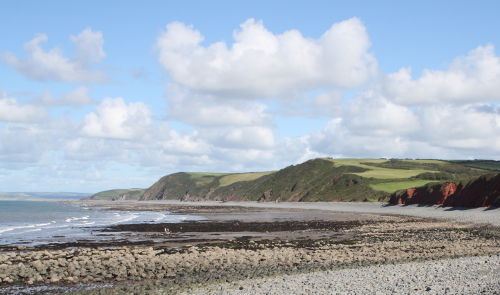
The winding path down the densely wooded Peppercombe Valley is approached on footnote1 from Horns Cross on the A39 between Bideford and Clovelly. Pass through the gate with a National Trust sign on it beyond the Coach and Horses car park and you soon find yourself in a tranquil woodland setting with no sound bar the occasional birdsong and the burbling of the stream that runs down the valley beside the path. Not far down the hill on the left-hand side is the quaint looking Bridge Cottage with its archetypal thatched roof, one of two Peppercombe properties available for holiday lets from the Landmark Trust. After the best part of a mile the track levels out and the wood gives way to a meadow with the second Landmark property Castle Bungalow at the far end. Follow the right-hand path seawards from here and you shortly join the North Devon section of the South West Coast Path from which there is access to a pebbly beach; to the east of this access point the stream ends its journey to the sea in a waterfall.

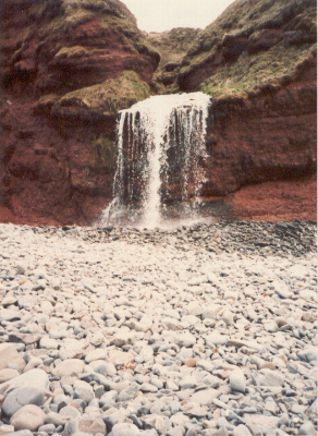
The valley was part of the Portledge Estate until it was purchased by the National Trust in 1988 from the Pine-Coffin family, owners of land in the area since Norman times when William the Conqueror gifted the manor of Alwington to Sir Richard Coffyn.
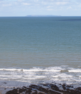
The impressive cliffs at Peppercombe are carved from red Triassic stonenote2, and afford vantage points from which to view the grand sweep of the coastline to the east and the westward arc to Hartland Point; look out to sea on a clear day and the isle of Lundy is visible on the horizon.
There are two Peppercombe cliffs that Polwhele draws to our attention in his History of Devonshire:
The next two sections provide some more information about these.

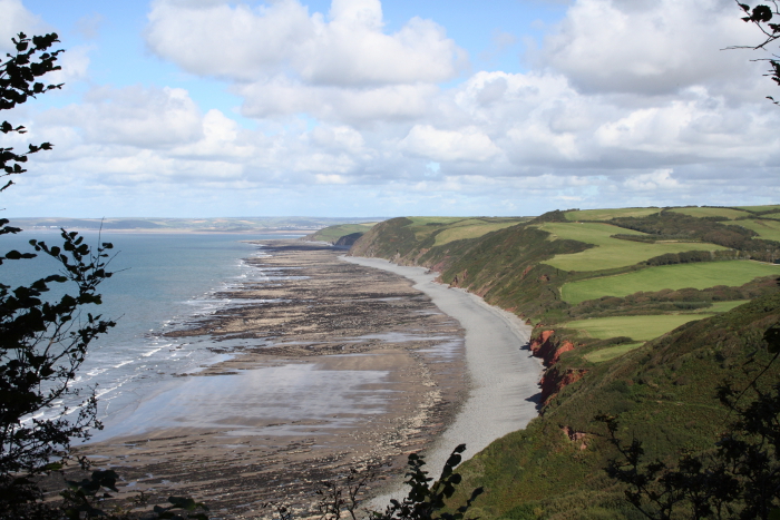
The top of the near-perpendicular section of cliff in the photo above is the site of Peppercombe Castle. This was once an Iron Age promontory hillfort. The South West Coast Path rises steeply here, passing through the castle site, but there is little to see of the original fortifications apart from some wall fragments hidden beneath the vegetation. A name plaque giving the grid reference is fixed to a thick horizontal wooden pole guarding the cliff edge. The effort of the ascent is rewarded by the magnificent bird's eye view of the coast from Portledge beach across Bideford Bay and beyond (pictured below) This vista is revealed through a gap to the right of the pole.

The latticed windowed Castle Bungalow, painted in the cream and brown colours recalling the livery of the old Great Western Railway, is seen in the picture above. This prefabricated dwelling was transported to the site and erected in 1923 by Boulton and Paul of Norwich, suppliers of ready-made "Residences, Bungalows and Cottages". The bungalow was sited beside what remained of the faux Peppercombe Castle, a much grander building with a tennis court, dubbed by the Landmark Trust 'a castellated seaside residence' that can be seen in a sepia photo on a postcard from 1906; by 1909 it had been abandoned after coastal erosion had rendered it unsafe and I presume it collapsed or was knocked down soon after.

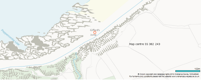
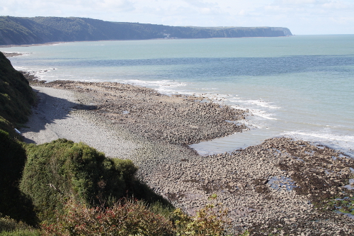
Since there appears to be no plaque designating it, the precise location of Giffard's Jump is hard to establish. Fortunately it is marked on the Ordnance Survey map which positions it close to the South West Coast Path, on the Peppercombe side of where the finer pebbles and sand of Portledge Beach give way to the larger stones and rocks of Peppercombe Beach which is where the photo below was taken. The cliffs have been subject to extensive erosion here over the years, so the alleged incident may have taken place at a spot that has since been washed away by the sea.
Hardinge F Giffard, a descendant of the eponymous Giffard published a paper in the Transactions of the Devonshire Association[3] in 1902 drawing on family tradition both aural and written to set the record straight concerning the circumstances surrounding this incident. Polwhele had suggested that it took place around 1740, whereas Hardinge says it happened much earlier on October 28th 1537 during the reign of King Henry VIII. This was the day on which Thomas Giffard, heir to the extensive Halsbury estates, married Margaret Monk.

The family tradition regarding this incident was encapsulated in a long and flowery poem written in 1791 by Sir A Hardinge Giffard that is quoted in full in the paper. I have reproduced the last 22 verses out of the 34 below (which should be read downwards). 'Lord Arthur' in the poem refers to Arthur Plantagenet, 1st Viscount Lisle. The bride Margaret Monk was the sister of Thomas Monk, who married Arthur Plantagenet's daughter.
|
'Come forth, my love' the bridegroom said, 'Come look upon the Severn Sea, Yon cliff that proudly lifts his head Shall be a seat for you and me'. In sportive mood the cliff they gained, The raptured pair the waters view'd, And o'er the edge their sight they strained To mark the wild waves fierce and rude. And still to trace the rocky beach, Mocking her husband's anxious eye, The giddy Margaret forth would stretch, And still another look would try. To lure her from this dangerous spot He turns to point each neighbouring scene - 'And look, my love, where Portledge Court Smiles lovely o'er the level green. 'And westward, dear, direct thine eyes Where pendent like a sea-bird's nest In quiet calm Clovelly lies Reposing on the cliff's high breast. 'See Hartland closing round the bay, Glamorgan's shadowy mountains view, And Lundy, braving ocean's sway And Dunster's heights of distant blue. 'Refrain, my dearest love, refrain, Nor wildly tempt this dreadful height; While o'er this giddy brink you strain, The shock may blind your dazzled sight.' Her footing fails - his powerful hand Saves her - but for a sight of woe, He sees her just securely stand, And he himself is hurled below. Oh, bear away that wretched bride A dismal road to Halsbury Hall, This morning saw her in her pride And noontide sees her reft of all. Lord Arthur is a wretched man To see that pale and lifeless child Who, when this dismal day began, In joy and health and beauty smiled. And far and near he sends for aid To every Leech of healing skill, And well are his commands obeyed, And soon that mourning hall they fill. |
But as each remedy applied Recalls her back to sense and life 'Tis but to tell that wretched bride That she no longer is a wife. And now a murmur rises round, His voice - his own loved voice - she hears; She rushes to the well-known sound And bathes him in her joyful tears. 'Oh, where and how, my dearest best, Restored to me and love and life; What angel could that fate arrest Sought by thy wretched, reckless wife?' 'My humblest grateful thanks,' he said, 'To the All-merciful are due, Whose arm has snatched me from the dead, Restored to life and love and you.' 'For He, without Whose Will, no hair Is idly from our temples shed, Even as I fell in middle air The means of safety round me spread. 'Twas where of old a ragged oak, That half-way down the cliff had grown Forth from a crevice in the rock Its old and tangled roots had thrown. With wild convulsive grasp my hands Upon that tangled root I flung, And pendent o'er the stony strand, In momentary safety hung. A jutting stone, a gadding briar, Were aids upon my perilous way, (Small are the aids that we require When love and life the prize display,) And soon to many a wondering friend, Lamenting my untimely doom, Did I the lower cliff ascend And hasten to this happy home.' He ceased, and well you may suppose The gratitude that Margaret felt, When in that evening's happy close, To pour her fervent thanks she knelt. Ages have pass'd and names are gone, But living still in local lore - Right well the Giffard's Leap is known To those who tread that rocky shore. |
I'm not sure that the coast of Glamorgannote3, Portledge Court(usually Manor), or any part of Dunster could ever be seen from Giffard's Jump. Let's just call it poetic license. However Lundy can most certainly be seen from Peppercombe.
Returning to the question of the precise location of Giffard's Jump, Hardinge F Giffard suggests in his paper that the drop was less precipitous at that time (1902).
Today the height of the cliff seems even greater than in Polwhele's time, and there is no level ground in the vicinity where a picnic could conceivably be held, suggesting that erosion of the cliff has continued apace.
From the 16th Century lime became the principal means of increasing soil fertility in Devon, and many limekilns were built along the North Devon coast including one at the head of the beach in Peppercombe. The kilns were used to yield lime from limestone imported by sea from South Wales.
The Peppercombe limekiln has been washed away by the sea long ago, but what does remain is the rectangular channel carved out of the rocky beach to provide better access for the ships bringing in the limestone. The picture above shows this artificial inlet which goes by the name of Peppercombe Lear, lear being a west-country dialect word for such a channel.